The Wild Atlantic Way runs about 2,500 km (≈1,600 miles) down Ireland’s west coast, from Donegal in the north to Kinsale in County Cork. You don’t drive all of it in one go — the trick is to take it in sections over a week, anchoring each day on one stretch of coast and leaving room for the villages and viewpoints in between.
FlapTrip is an AI travel planner that helps travellers turn a rough idea into a clear, day-by-day trip they can edit, follow, and share — ideal for a long coastal route like this.
This is for travellers doing a self-drive trip down Ireland’s west coast who want the cliffs, the peninsulas and the small-town pubs — not a checklist sprint between cities.
A 7-day Wild Atlantic Way itinerary
Driven north to south:
- Day 1 — Donegal: the towering sea cliffs of Slieve League and the wild Donegal coast.
- Day 2 — Sligo & Mayo: Benbulben, surf beaches, and the long empty roads of the north-west.
- Day 3 — Galway & Connemara: Galway city as a base, with a Connemara loop of bogland, lakes and the Sky Road.
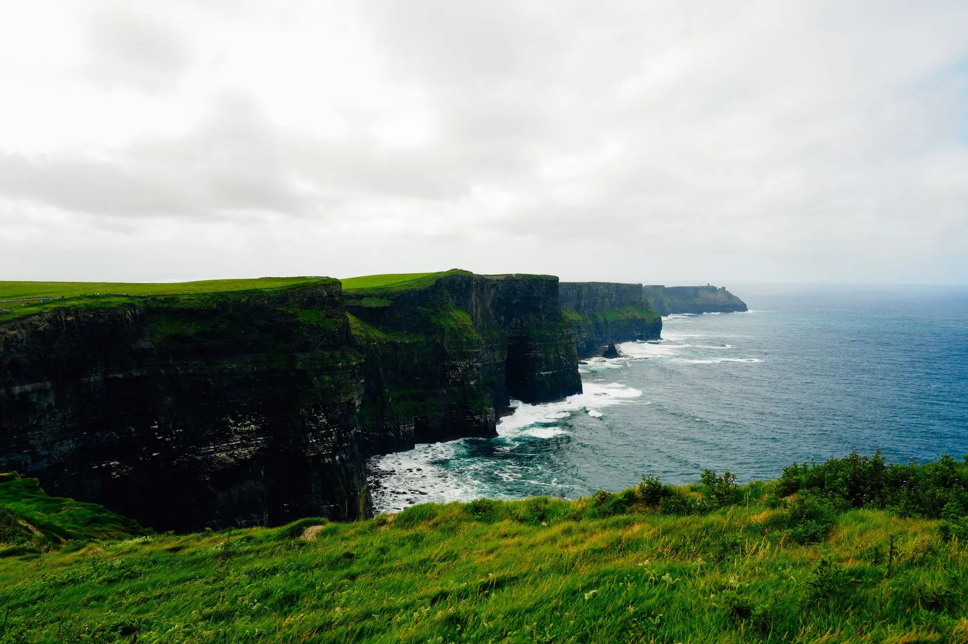
- Day 4 — The Cliffs of Moher & the Burren: Ireland’s most famous cliffs, then the lunar limestone landscape of the Burren.
- Day 5 — Dingle Peninsula: the Slea Head Drive — arguably the most beautiful single stretch on the whole route.
- Day 6 — Ring of Kerry: the classic Iveragh peninsula loop; start early to stay ahead of the tour coaches.
- Day 7 — Kinsale & Cork: finish in the colourful harbour town of Kinsale, Ireland’s foodie corner.
Keep the coastal days honest
West-coast roads are slow and gorgeous — distances that look short on a map take far longer in reality. FlapTrip builds the route day by day and flags a day that’s secretly too much driving, keeps a running budget for fuel, ferries and B&Bs so the trip stays on plan, and lets you share it as a link or QR code so the whole car is following the same day.
When to go
May, June and September are the sweet spot — long days, smaller crowds, and a better chance of the famously changeable Atlantic weather behaving. July–August is busiest; winter is dramatic but daylight is short.
FAQ
How long is the Wild Atlantic Way?
About 2,500 km (≈1,600 miles) along Ireland’s entire west coast — one of the longest defined coastal driving routes in the world.
How many days do you need?
A week covers the highlights at a reasonable pace; 10–14 days lets you slow down and explore the peninsulas properly.
Which direction should I drive it?
Either, but north-to-south (Donegal to Kinsale) is the most common, finishing near Cork airport and the foodie town of Kinsale.
Can FlapTrip plan an Ireland road trip itinerary?
Yes — give it your start, finish, dates and interests and it drafts a day-by-day west-coast route you can edit, with over-long driving days flagged and the budget tracked.
The short version
The Wild Atlantic Way is best driven in sections over a week, one coastal stretch per day, with time for the villages between. Want the underlying method? See how to plan a road trip route — or browse the best road trips in the world. Or let FlapTrip draft the day-by-day route for you.
Photo: Adrien Olichon / Pexels.